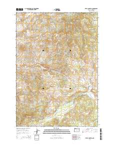
2014 Map of Keyes Mountain
USGS Topo · Published 2014About this map
Keyes Mountain and Mitchell Mtn anchor this high-elevation landscape in the eastern Ochoco Mountains. The topography is defined by sharp elevation shifts and numerous water sources, including Maxwell Spring and Looney Spring, which feed into complex drainage systems like Keyes Cr and Mountain Cr. The central corridor is dominated by the Ochoco Hwy, which traverses the terrain toward Keys Creek Summit, a critical high point for regional travel. Evidence of the area's grazing and timber history appears in features like Bearway Meadow and the Monroe Roughs, while landmarks like Lewis Rock and Peggy Butte serve as distinct navigational markers across the township lines of Wheeler County.
Find a feature on this map
33 named features on this map. Tap any name to fly to it.
Don’t see what you’re looking for? This feature index may not catch every label — zoom into the map to look around manually.
Map Details
Editions of this 2014 Keyes Mountain Map
This is the sole edition of this map. No revisions or reprints were ever made.
Other maps of this area

1926 · Mitchell
USGS Topo · 1:125,000

1932 · Dayville
USGS Topo · 1:125,000

1936 · Dayville
USGS Topo · 1:125,000

1953 · Richmond
USGS Topo · 1:62,500

1955 · Bend
USGS Topo · 1:250,000

1955 · Canyon City
USGS Topo · 1:250,000

1957 · Bend
USGS Topo · 1:250,000

1958 · Bend
USGS Topo · 1:250,000

1959 · Canyon City
USGS Topo · 1:250,000

1966 · Peterson Point
USGS Topo · 1:24,000