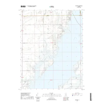
2018 Map of Keyesport
USGS Topo · Published 2018About this map
Carlyle Lake dominates the central and eastern portions of this landscape, its waters shaped by the Kaskaskia River and engineered structures like the Saddle Dam 2 Leeve. This 2018 survey captures the region as a primary recreation and conservation hub, where Hazlet Park Rd leads into the lake's protected shores. Small-scale human history is preserved in a network of family and community burial grounds, including McKendree Cem, Gillespie Cem, and Gerdes Cem, which are scattered throughout the rural sections of Clinton Co.
Find a feature on this map
47 named features on this map. Tap any name to fly to it.
Don’t see what you’re looking for? This feature index may not catch every label — zoom into the map to look around manually.
Map Details
Editions of this 2018 Keyesport Map
This is the sole edition of this map. No revisions or reprints were ever made.
Other maps of this area

1910 · Carlyle
USGS Topo · 1:62,500

1914 · Centralia
USGS Topo · 1:62,500

1932 · Greenville
USGS Topo · 1:62,500

1935 · Centralia
USGS Topo · 1:62,500

1939 · Greenville
USGS Topo · 1:62,500

1943 · Greenville
USGS Topo · 1:62,500

1945 · Vandalia
USGS Topo · 1:62,500

1947 · Vandalia
USGS Topo · 1:62,500

1948 · Carlyle
USGS Topo · 1:62,500

1958 · Belleville
USGS Topo · 1:250,000