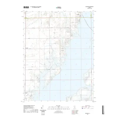
2021 Map of Keyesport
USGS Topo · Published 2021About this map
Carlyle Lake dominates this portion of the Clinton and Bond county line, its expansive waters and irregular shoreline defining the local geography. The village of Keyesport sits at the northern edge of the reservoir, where the community grid meets the water at W Davis St and Washington St. This modern survey illustrates the proximity of recreation and rural life, with Hazlet Park Rd providing access to the shoreline while agricultural tracts remain nearby.
Find a feature on this map
42 named features on this map. Tap any name to fly to it.
Don’t see what you’re looking for? This feature index may not catch every label — zoom into the map to look around manually.
Map Details
Editions of this 2021 Keyesport Map
This is the sole edition of this map. No revisions or reprints were ever made.
Other maps of this area

1910 · Carlyle
USGS Topo · 1:62,500

1914 · Centralia
USGS Topo · 1:62,500

1932 · Greenville
USGS Topo · 1:62,500

1935 · Centralia
USGS Topo · 1:62,500

1939 · Greenville
USGS Topo · 1:62,500

1943 · Greenville
USGS Topo · 1:62,500

1945 · Vandalia
USGS Topo · 1:62,500

1947 · Vandalia
USGS Topo · 1:62,500

1948 · Carlyle
USGS Topo · 1:62,500

1958 · Belleville
USGS Topo · 1:250,000