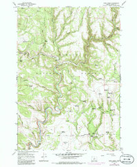
1966 Map of Keys Creek
USGS Topo · Published 1985About this map
Och Oco National Forest defines this high-desert reach of Crooked River country, where the landscape is marked by a complex network of seasonal drainages and stock-water management. The North Fork Crooked River enters from the south, carving through terrain punctuated by local features like Deadline Flat and Buck Hollow. This 1966 field-checked survey highlights the region's reliance on water infrastructure for ranching and forest management, documented through numerous named water sources such as Cary Reservoir, Indian Creek Reservoir, and Amber Reservoir.
Find a feature on this map
58 named features on this map. Tap any name to fly to it.
Don’t see what you’re looking for? This feature index may not catch every label — zoom into the map to look around manually.
Map Details
Editions of this 1966 Keys Creek Map
2 editions found
Other maps of this area

1932 · Dayville
USGS Topo · 1:125,000

1936 · Dayville
USGS Topo · 1:125,000

1955 · Bend
USGS Topo · 1:250,000

1955 · Canyon City
USGS Topo · 1:250,000

1957 · Bend
USGS Topo · 1:250,000

1958 · Bend
USGS Topo · 1:250,000

1959 · Canyon City
USGS Topo · 1:250,000

1965 · Williams Prairie
USGS Topo · 1:24,000

1966 · Keys Creek
USGS Topo · 1:24,000

1966 · Peterson Point
USGS Topo · 1:24,000