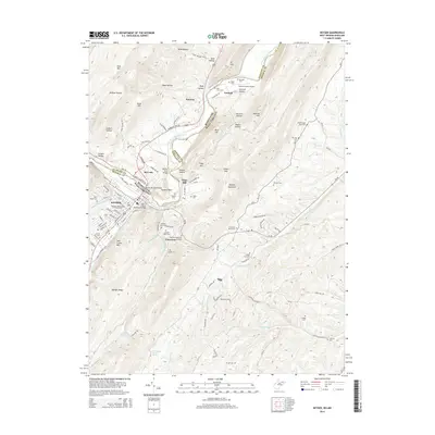
2014 Map of Keyser
USGS Topo · Published 2014About this map
Keyser sits at a critical junction of the North Branch Potomac River and the B & O RR, serving as a primary hub where West Virginia meets Maryland. The landscape is defined by the steep rise of Dans Mtn and Knobly Mountain, forcing transportation networks like the McMullen Hwy SW into narrow corridors along the water. Educational and civic infrastructure is prominent, centered on the Potomac State College of W Virginia Univ and the memorials of the SSGT J E Kelly Memorial Bridge.
Find a feature on this map
107 named features on this map. Tap any name to fly to it.
Don’t see what you’re looking for? This feature index may not catch every label — zoom into the map to look around manually.
Map Details
Editions of this 2014 Keyser Map
This is the sole edition of this map. No revisions or reprints were ever made.
Other maps of this area

1891 · Romney
USGS Topo · 1:125,000

1895 · Piedmont
USGS Topo · 1:125,000

1898 · Frostburg
USGS Topo · 1:62,500

1899 · Grantsville
USGS Topo · 1:62,500

1901 · Frostburg
USGS Topo · 1:62,500

1904 · Grantsville
USGS Topo · 1:62,500

1908 · Frostburg
USGS Topo · 1:62,500

1919 · Elk Garden
USGS Topo · 1:48,000

1920 · Elk Garden
USGS Topo · 1:48,000

1920 · Keyser
USGS Topo · 1:62,500