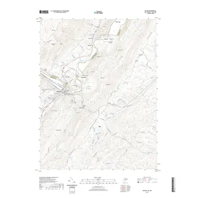
2019 Map of Keyser
USGS Topo · Published 2019About this map
Keyser serves as a focal point along the North Branch Potomac River, where the Mineral County Courthouse and Mineral County Judicial Annex anchor the civic landscape. The river boundary between West Virginia and Maryland is bridged by the Keyser McCoole Bridge and the SSGT J E Kelly Memorial Bridge, connecting the town to McCoole and the slopes of Dans Mtn. To the north and south, rural life is marked by several small family and community burial grounds, including the Poor Farm Cem, Baker Cem, and Umstot Cem. The terrain is defined by prominent ridges like Knobly Mtn and New Creek Mtn, with the American Discovery Trail winding through the valley. This landscape illustrates a transition from the dense street grid of the county seat to the agricultural and aviation uses found at Gerstell Farms Airport near Gerstell.
Find a feature on this map
117 named features on this map. Tap any name to fly to it.
Don’t see what you’re looking for? This feature index may not catch every label — zoom into the map to look around manually.
Map Details
Editions of this 2019 Keyser Map
This is the sole edition of this map. No revisions or reprints were ever made.
Other maps of this area

1891 · Romney
USGS Topo · 1:125,000

1895 · Piedmont
USGS Topo · 1:125,000

1898 · Frostburg
USGS Topo · 1:62,500

1899 · Grantsville
USGS Topo · 1:62,500

1901 · Frostburg
USGS Topo · 1:62,500

1904 · Grantsville
USGS Topo · 1:62,500

1908 · Frostburg
USGS Topo · 1:62,500

1919 · Elk Garden
USGS Topo · 1:48,000

1920 · Elk Garden
USGS Topo · 1:48,000

1920 · Keyser
USGS Topo · 1:62,500