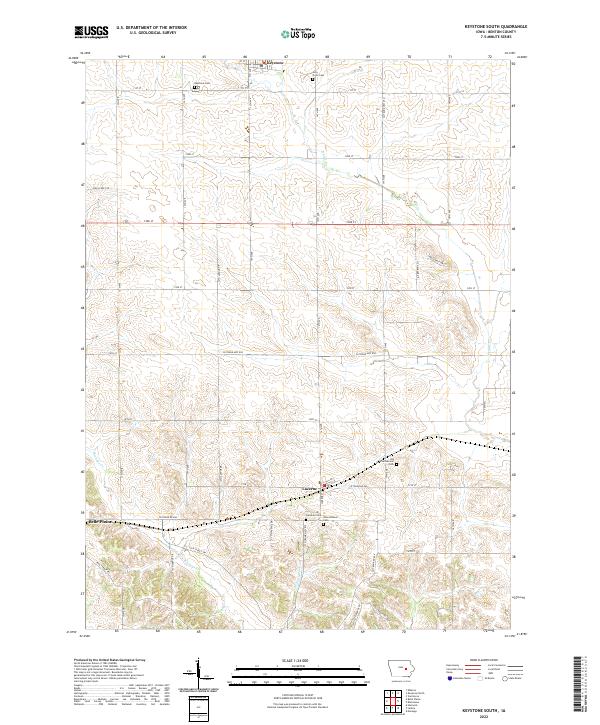
2022 Map of Keystone South
USGS Topo · Published 2022About this map
Luzerne sits at the center of this Benton County landscape, where the agricultural grid is defined by a dense network of country roads and section lines. The area is marked by a notable concentration of small burial grounds that reflect the early settlement patterns of the region, including the Holy Cross Cem and Keystone Cem in the north, and a cluster near the town center featuring the Lutheran Cem, International Cem, and the Old International Cem.
Find a feature on this map
31 named features on this map. Tap any name to fly to it.
Don’t see what you’re looking for? This feature index may not catch every label — zoom into the map to look around manually.
Map Details
Editions of this 2022 Keystone South Map
This is the sole edition of this map. No revisions or reprints were ever made.
Other maps of this area

1954 · Waterloo
USGS Topo · 1:250,000

1954 · Des Moines
USGS Topo · 1:250,000

1955 · Waterloo
USGS Topo · 1:250,000

1956 · Des Moines
USGS Topo · 1:250,000

1957 · Des Moines
USGS Topo · 1:250,000

1965 · Ladora
USGS Topo · 1:24,000

1965 · Keystone South
USGS Topo · 1:24,000
1965 · Marengo
USGS Topo · 1:24,000
1965 · Blairstown
USGS Topo · 1:24,000

1968 · Belle Plaine
USGS Topo · 1:24,000