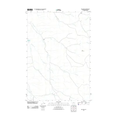
2011 Map of Kid Creek
USGS Topo · Published 2011About this map
Millers Ranch stands as a primary landmark in this ranching landscape of Big Horn County, situated near the headwaters of Little Owl Creek. The terrain is defined by a dense network of seasonal drainages, including Kid Creek and Little Beaver Creek, which carve through the foothills of the Wolf Mountains. The geography here reflects a dedicated livestock and water-management economy, anchored by improvements like Steinhilber Reservoir and a system of back-country roads such as Sioux Pass Creek Rd and Indian Creek Rd. To the north, the elevation rises toward Sioux Pass, a critical transition point for local travel. This 2011 survey captures the area's rural character, where large landholdings are connected by long-established routes like Bear Creek Rd and Youngs Creek Rd, maintaining the spatial patterns of Montana's high-country ranching tradition.
Find a feature on this map
18 named features on this map. Tap any name to fly to it.
Don’t see what you’re looking for? This feature index may not catch every label — zoom into the map to look around manually.
Map Details
Editions of this 2011 Kid Creek Map
This is the sole edition of this map. No revisions or reprints were ever made.
Other maps of this area

1894 · Rosebud
USGS Topo · 1:125,000

1901 · Rosebud
USGS Topo · 1:125,000

1954 · Hardin
USGS Topo · 1:250,000

1957 · Hardin
USGS Topo · 1:250,000

1958 · Hardin
USGS Topo · 1:250,000

1967 · Kid Creek
USGS Topo · 1:24,000

1967 · Wolf Mountain Lookout
USGS Topo · 1:24,000

1967 · Bar V Ranch NE
USGS Topo · 1:24,000
1967 · Bar V Ranch
USGS Topo · 1:24,000
1967 · Wyola NE
USGS Topo · 1:24,000