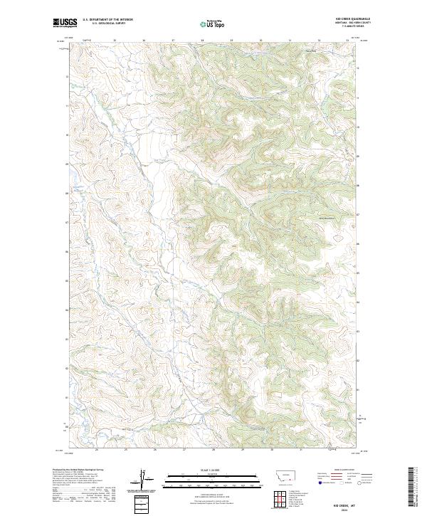
2024 Map of Kid Creek
USGS Topo · Published 2024About this map
The Wolf Mountains dominate the eastern landscape of this Montana quadrangle, where the terrain transitions into a complex network of drainages and passes. In the northern reaches, Sioux Pass serves as a natural corridor near the headwaters of North Fork Sioux Pass Creek and Sioux Pass Creek. The map reveals a land defined by its water sources, from the Steinhilber Reservoir in the west to the winding courses of Kid Creek and Little Owl Creek. A series of rural routes, including Owl Creek Rd and Bear Creek Rd, navigate the varied topography, connecting the isolated watersheds of Dry Beaver Creek and Little Beaver Creek. This detailed 2024 survey documents the enduring ranching and geographical character of the Big Horn region, capturing the relationship between high ridges and the vital creek bottoms below.
Find a feature on this map
20 named features on this map. Tap any name to fly to it.
Don’t see what you’re looking for? This feature index may not catch every label — zoom into the map to look around manually.
Map Details
Editions of this 2024 Kid Creek Map
This is the sole edition of this map. No revisions or reprints were ever made.
Other maps of this area

1894 · Rosebud
USGS Topo · 1:125,000

1901 · Rosebud
USGS Topo · 1:125,000

1954 · Hardin
USGS Topo · 1:250,000

1957 · Hardin
USGS Topo · 1:250,000

1958 · Hardin
USGS Topo · 1:250,000

1967 · Kid Creek
USGS Topo · 1:24,000

1967 · Wolf Mountain Lookout
USGS Topo · 1:24,000

1967 · Bar V Ranch NE
USGS Topo · 1:24,000
1967 · Bar V Ranch
USGS Topo · 1:24,000
1967 · Wyola NE
USGS Topo · 1:24,000