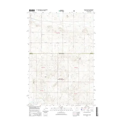
2015 Map of Kid Rich Butte
USGS Topo · Published 2015About this map
Grand River National Grassland dominates the southern half of this landscape, marking a transition between the open prairie of North Dakota and South Dakota. This quadrangle is defined by a series of prominent high points that break the horizon, including Big Butte, Castle Butte, and Wolf Butte. The local topography is further shaped by the drainage patterns of Flat Cr and the North Fork Grand River in the southwestern corner. While the area is largely characterized by its natural features and rangeland, a network of rural roads like Country Club Rd and Cemetary Rd provides access to the sectioned land. The presence of Kid Rich Butte in the southwest offers a specific landmark for those tracing the geographic history and land use of the state border region.
Find a feature on this map
24 named features on this map. Tap any name to fly to it.
Don’t see what you’re looking for? This feature index may not catch every label — zoom into the map to look around manually.
Map Details
Editions of this 2015 Kid Rich Butte Map
This is the sole edition of this map. No revisions or reprints were ever made.
Other maps of this area

1953 · Dickinson
USGS Topo · 1:250,000

1954 · Lemmon
USGS Topo · 1:250,000

1957 · Dickinson
USGS Topo · 1:250,000

1957 · Lemmon
USGS Topo · 1:250,000

1974 · Hettinger North
USGS Topo · 1:24,000

1974 · Hettinger South
USGS Topo · 1:24,000

1974 · Kid Rich Butte
USGS Topo · 1:24,000

1974 · Haynes
USGS Topo · 1:24,000

1980 · Mott
USGS Topo · 1:100,000

1983 · Lodgepole SE
USGS Topo · 1:24,000