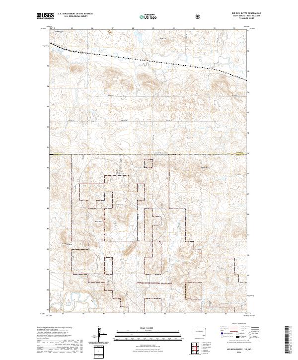
2021 Map of Kid Rich Butte
USGS Topo · Published 2021About this map
The Grand River National Grassland dominates the southern landscape of this high plains region, where the North Fork Grand River cuts through the prairie. Rising from the surrounding tableland are several prominent geological landmarks including Kid Rich Butte, Wolf Butte, and Castle Butte, which provided essential navigational markers for early travelers and homesteaders. The map documents the border between Adams and Perkins counties, as well as the state line dividing North Dakota and South Dakota. A sparse network of section-line roads, such as Cemetery Rd and Castle Butte Rd, connects the scattered ranchlands. Water sources are critical in this arid environment, evidenced by the drainage of Flat Cr as it winds past Big Butte toward the river system below.
Find a feature on this map
25 named features on this map. Tap any name to fly to it.
Don’t see what you’re looking for? This feature index may not catch every label — zoom into the map to look around manually.
Map Details
Editions of this 2021 Kid Rich Butte Map
This is the sole edition of this map. No revisions or reprints were ever made.
Other maps of this area

1953 · Dickinson
USGS Topo · 1:250,000

1954 · Lemmon
USGS Topo · 1:250,000

1957 · Dickinson
USGS Topo · 1:250,000

1957 · Lemmon
USGS Topo · 1:250,000

1974 · Hettinger North
USGS Topo · 1:24,000

1974 · Hettinger South
USGS Topo · 1:24,000

1974 · Kid Rich Butte
USGS Topo · 1:24,000

1974 · Haynes
USGS Topo · 1:24,000

1980 · Mott
USGS Topo · 1:100,000

1983 · Lodgepole SE
USGS Topo · 1:24,000