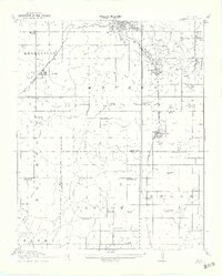
1914 Map of Kiefer
USGS Topo · Published 1914About this map
Sapulpa and Kiefer emerge as industrial hubs in this 1914 survey, which documents the early oil and rail landscape of eastern Oklahoma. The map clearly illustrates the petroleum infrastructure of the era, specifically the clusters of Oil Tanks south of Glenpool. Transportation networks like the St Louis San Francisco and the Midland Valley railroad lines converge here, linking settlements such as Kellyville and Mounds to the broader regional economy.
Find a feature on this map
62 named features on this map. Tap any name to fly to it.
Don’t see what you’re looking for? This feature index may not catch every label — zoom into the map to look around manually.
Map Details
Editions of this 1914 Kiefer Map
2 editions found
Other maps of this area

1896 · Okmulgee
USGS Topo · 1:125,000

1900 · Okmulgee
USGS Topo · 1:125,000

1901 · Claremore
USGS Topo · 1:125,000

1901 · Nuyaka
USGS Topo · 1:125,000

1912 · Hominy
USGS Topo · 1:125,000

1914 · Kiefer
USGS Topo · 1:62,500

1914 · Claremore
USGS Topo · 1:125,000

1915 · Hominy
USGS Topo · 1:125,000

1916 · Kiefer
USGS Topo · 1:62,500

1916 · Claremore
USGS Topo · 1:125,000