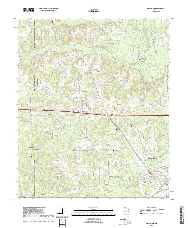
2022 Map of Kilgore NW
USGS Topo · Published 2022About this map
Kilgore anchors the southeastern corner of this East Texas survey, where the landscape transitions from the urban edges of the city into the rolling, creek-cut woodlands of the Smith and Gregg county line. The topography is defined by a dense network of waterways, including the Sabine River and its numerous tributaries such as Rabbit Cr, Prairie Cr, and Peavine Cr. At the heart of the map, Liberty City sits at a crossroads of commerce and local transit, surrounded by residential developments with street names like Spokane St and Meridian St.
Find a feature on this map
159 named features on this map. Tap any name to fly to it.
Don’t see what you’re looking for? This feature index may not catch every label — zoom into the map to look around manually.
Map Details
Editions of this 2022 Kilgore NW Map
This is the sole edition of this map. No revisions or reprints were ever made.
Other maps of this area

1936 · Kilgore
USGS Topo · 1:48,000

1938 · Winona
USGS Topo · 1:48,000

1940 · Kilgore
USGS Topo · 1:62,500

1943 · Winona
USGS Topo · 1:62,500

1956 · Tyler
USGS Topo · 1:250,000

1960 · Big Sandy
USGS Topo · 1:24,000

1960 · White Oak
USGS Topo · 1:24,000

1960 · Gladewater
USGS Topo · 1:24,000

1966 · Hope Pond
USGS Topo · 1:24,000
1966 · Starrville
USGS Topo · 1:24,000