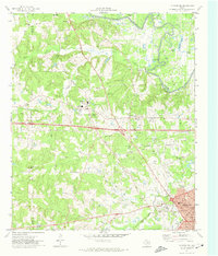
1971 Map of Kilgore NW
USGS Topo · Published 1974About this map
The Sabine River winds through the northern landscape of this 1970s survey, marking a terrain defined by the East Texas oil industry and established rural communities. The northwest corner of Kilgore anchors the lower map, where the Missouri Pacific railroad corridor meets Houston St and Commerce St. The area shows a high density of Oil Wells interspersed with historic family and community landmarks, particularly along the Smith Co and Gregg Co boundary. Significant social centers include Liberty City and Clarksville City, alongside institutions like Sabine High Sch and North Chapel Sch. For genealogists, the map is a vital resource for locating rural burial sites such as Mt Pleasant Cem, Strong Memorial Cem, and Goodman Cem, which sit near old transportation routes like Old Kilgore Highway and Swamp City Road.
Find a feature on this map
46 named features on this map. Tap any name to fly to it.
Don’t see what you’re looking for? This feature index may not catch every label — zoom into the map to look around manually.
Map Details
Editions of this 1971 Kilgore NW Map
This is the sole edition of this map. No revisions or reprints were ever made.
Other maps of this area

1936 · Kilgore
USGS Topo · 1:48,000

1938 · Winona
USGS Topo · 1:48,000

1940 · Kilgore
USGS Topo · 1:62,500

1943 · Winona
USGS Topo · 1:62,500

1956 · Tyler
USGS Topo · 1:250,000

1960 · Big Sandy
USGS Topo · 1:24,000

1960 · White Oak
USGS Topo · 1:24,000

1960 · Gladewater
USGS Topo · 1:24,000

1966 · Hope Pond
USGS Topo · 1:24,000
1966 · Starrville
USGS Topo · 1:24,000