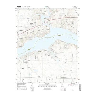
2014 Map of Killen
USGS Topo · Published 2014About this map
Wilson Lake and the Tennessee River dominate this landscape, serving as the geographic divide between Lauderdale and Colbert counties. The north bank is characterized by a dense network of residential developments overlooking the water, including Emerald Shores, Lakeview, and Lingerlost. Further inland, the historic settlement of St. Florian sits near the headwaters of Wilson Creek. To the south, the industrial and commercial expansion around Muscle Shoals and Ford City contrasts with the numerous family burial grounds that dot the countryside. Genealogists will find several notable sites such as Kernachan Cem and Whitmore Cem near Wilson Lake Shores, as well as Jones Hill Cemetery near Lockland. The map also details early transportation infrastructure like the Shoal Creek Bridge and the Tennessee River Drive railroad corridor.
Find a feature on this map
170 named features on this map. Tap any name to fly to it.
Don’t see what you’re looking for? This feature index may not catch every label — zoom into the map to look around manually.
Map Details
Editions of this 2014 Killen Map
This is the sole edition of this map. No revisions or reprints were ever made.
Other maps of this area

1914 · Rogersville
USGS Topo · 1:48,000

1914 · Muscle Shoals
USGS Topo · 1:48,000

1916 · Muscle Shoals
USGS Topo · 1:62,500

1916 · Rogersville
USGS Topo · 1:62,500

1924 · Tuscumbia
USGS Topo · 1:48,000

1926 · Tuscumbia
USGS Topo · 1:62,500

1936 · Pruitton
USGS Topo · 1:24,000

1936 · Wheeler Dam
USGS Topo · 1:24,000

1936 · Florence
USGS Topo · 1:24,000

1936 · Town Creek
USGS Topo · 1:24,000