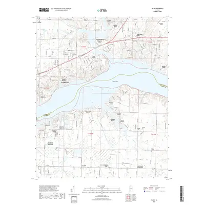
2018 Map of Killen
USGS Topo · Published 2018About this map
Wilson Lake dominates this Alabama landscape, where the waters of the Tennessee River divide Lauderdale and Colbert counties. The map captures a transition from the urban reach of Florence and St. Florian to the lakeside residential developments of Alabama Shores and Paradise Points. Significant industrial and transportation markers include the Northwest Alabama Regional Airport and the planned grids of Nitrate City and Listerhill to the south. Genealogists will find a high density of family burial grounds preserved among the hills and inlets, such as Kernachan Cem, Hennigan Cem, and Jones Hill Cem. The shoreline is heavily indented by creeks like Sixmile Cr and McKernan Cr, illustrating how the impoundment of Muscle Shoals reshaped the local geography into a complex network of points and coves.
Find a feature on this map
205 named features on this map. Tap any name to fly to it.
Don’t see what you’re looking for? This feature index may not catch every label — zoom into the map to look around manually.
Map Details
Editions of this 2018 Killen Map
This is the sole edition of this map. No revisions or reprints were ever made.
Other maps of this area

1914 · Rogersville
USGS Topo · 1:48,000

1914 · Muscle Shoals
USGS Topo · 1:48,000

1916 · Muscle Shoals
USGS Topo · 1:62,500

1916 · Rogersville
USGS Topo · 1:62,500

1924 · Tuscumbia
USGS Topo · 1:48,000

1926 · Tuscumbia
USGS Topo · 1:62,500

1936 · Pruitton
USGS Topo · 1:24,000

1936 · Wheeler Dam
USGS Topo · 1:24,000

1936 · Florence
USGS Topo · 1:24,000

1936 · Town Creek
USGS Topo · 1:24,000