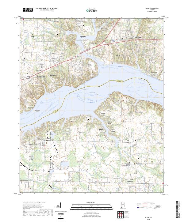
2024 Map of Killen
USGS Topo · Published 2024About this map
Wilson Lake and the Tennessee River dominate this modern landscape, defining the border between Lauderdale and Colbert counties. The map records a dense pattern of residential development along the northern shoreline, including Lauderdale Beach, Emerald Shores, and Hideaway Hills, contrasting with the industrial and agricultural character further south. Near the historical site of the Bainbridge Ferry, the topography transitions into the industrial corridor around Listerhill and Nitrate City.
Find a feature on this map
214 named features on this map. Tap any name to fly to it.
Don’t see what you’re looking for? This feature index may not catch every label — zoom into the map to look around manually.
Map Details
Editions of this 2024 Killen Map
This is the sole edition of this map. No revisions or reprints were ever made.
Other maps of this area

1914 · Rogersville
USGS Topo · 1:48,000

1914 · Muscle Shoals
USGS Topo · 1:48,000

1916 · Muscle Shoals
USGS Topo · 1:62,500

1916 · Rogersville
USGS Topo · 1:62,500

1924 · Tuscumbia
USGS Topo · 1:48,000

1926 · Tuscumbia
USGS Topo · 1:62,500

1936 · Pruitton
USGS Topo · 1:24,000

1936 · Wheeler Dam
USGS Topo · 1:24,000

1936 · Florence
USGS Topo · 1:24,000

1936 · Town Creek
USGS Topo · 1:24,000