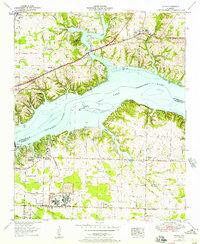
1953 Map of Killen
USGS Topo · Published 1957About this map
Wilson Dam stands as the monumental centerpiece of this mid-century landscape, anchoring the boundary between Lauderdale and Colbert counties. The creation of Wilson Lake transformed the Tennessee River into a massive reservoir, submerging former riverbanks while giving rise to industrial developments like Listerhill and Nitrate City. This industrial expansion is evidenced by the complex infrastructure of settling basins, pumping stations, and the large Tailings pond associated with the regional aluminum and fertilizer production.
Find a feature on this map
52 named features on this map. Tap any name to fly to it.
Don’t see what you’re looking for? This feature index may not catch every label — zoom into the map to look around manually.
Map Details
Editions of this 1953 Killen Map
This is the sole edition of this map. No revisions or reprints were ever made.
Other maps of this area

1914 · Rogersville
USGS Topo · 1:48,000

1914 · Muscle Shoals
USGS Topo · 1:48,000

1916 · Muscle Shoals
USGS Topo · 1:62,500

1916 · Rogersville
USGS Topo · 1:62,500

1924 · Tuscumbia
USGS Topo · 1:48,000

1926 · Tuscumbia
USGS Topo · 1:62,500

1936 · Pruitton
USGS Topo · 1:24,000

1936 · Wheeler Dam
USGS Topo · 1:24,000

1936 · Florence
USGS Topo · 1:24,000

1936 · Town Creek
USGS Topo · 1:24,000