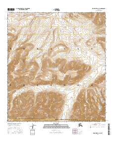
2016 Map of Killik River A-1 SE
USGS Topo · Published 2016About this map
Gates of the Arctic National Park encompasses nearly the entirety of this remote interior Alaska landscape, where the high Arctic drainage systems are meticulously documented. The terrain is defined by the sharp elevations of Marker Mtn, which serves as a central landmark amidst a complex network of glacial valleys and headwaters. Two primary watercourses, Sulugiak Creek in the northern reaches and Agiagiak Creek winding through the south, illustrate the natural flow of the Brooks Range watershed. The southern boundary of the map identifies the administrative divide between the North Slope Borough and the Yukon-Koyukuk Census Area. This topographic study provides a precise record of the unpopulated wilderness and high-altitude relief in the early twenty-first century, useful for understanding the hydrologic patterns and natural boundaries of this protected northern ecosystem.
Find a feature on this map
14 named features on this map. Tap any name to fly to it.
Don’t see what you’re looking for? This feature index may not catch every label — zoom into the map to look around manually.
Map Details
Editions of this 2016 Killik River A-1 SE Map
This is the sole edition of this map. No revisions or reprints were ever made.
Other maps of this area

1951 · Survey Pass
USGS Topo · 1:250,000

1951 · Chandler Lake
USGS Topo · 1:250,000

1951 · Killik River
USGS Topo · 1:250,000

1951 · Wiseman
USGS Topo · 1:250,000

1956 · Wiseman
USGS Topo · 1:250,000

1956 · Survey Pass
USGS Topo · 1:250,000

1956 · Chandler Lake
USGS Topo · 1:250,000

1956 · Killik River
USGS Topo · 1:250,000

1964 · Survey Pass
USGS Topo · 1:250,000

1964 · Wiseman
USGS Topo · 1:250,000