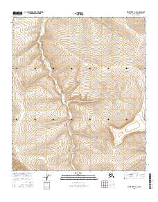
2016 Map of Killik River D-1 SE
USGS Topo · Published 2016About this map
Coal Creek flows through the center of this remote North Slope landscape, marking a terrain defined by steep drainage patterns and high-elevation relief. This 2016 survey by the U.S. Geological Survey illustrates a wilderness largely untouched by development, where the seasonal waters of the S Fork Ninuluk Creek and Coal Creek serve as the primary landmarks across several townships. The contour lines reveal the complex topography of the Brooks Range foothills, showcasing the natural erosion patterns of the Arctic watershed. Researchers and collectors of Alaskan geography can trace the physical geography of the North Slope Borough during a period of modern geospatial mapping, capturing the area in its raw natural state.
Find a feature on this map
8 named features on this map. Tap any name to fly to it.
Don’t see what you’re looking for? This feature index may not catch every label — zoom into the map to look around manually.
Map Details
Editions of this 2016 Killik River D-1 SE Map
This is the sole edition of this map. No revisions or reprints were ever made.
Other maps of this area

1951 · Chandler Lake
USGS Topo · 1:250,000

1951 · Killik River
USGS Topo · 1:250,000

1956 · Chandler Lake
USGS Topo · 1:250,000

1956 · Killik River
USGS Topo · 1:250,000

1964 · Chandler Lake
USGS Topo · 1:250,000
1986 · Killik River D-1
USGS Topo · 1:63,360
1986 · Killik River C-1
USGS Topo · 1:63,360
1987 · Chandler Lake C-5
USGS Topo · 1:63,360
1987 · Chandler Lake D-5
USGS Topo · 1:63,360
2016 · Killik River C-1 NW
USGS Topo · 1:25,000