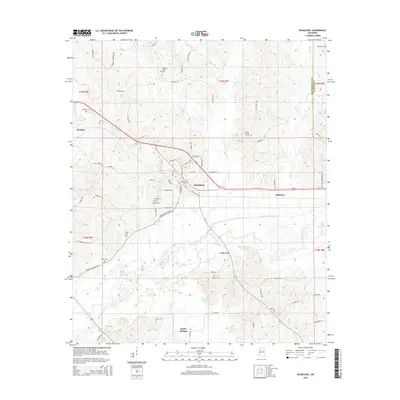
2015 Map of Kilmichael
USGS Topo · Published 2015About this map
Kilmichael serves as the central hub of this North Central Mississippi landscape, situated at the intersection of local routes like Vaiden Kilmichael Rd and Castle Rd. The settlement pattern follows the drainage of the Big Black River and its engineered counterpart, the Big Black River Canal, which cuts through the southern reaches. Numerous small family or community burial grounds, including Stinson Cem near the river and Wilmount Cem further north, suggest long-established family homesteads and rural congregations. The terrain is defined by a dense network of tributaries such as Mulberry Cr, Flowers Cr, and Wolf Cr, which flow into the primary river valley. To the south, the community of Poplar Springs sits near the headwaters of Poplar Cr, illustrating the reliance of these early settlements on the local watershed for both navigation and resources.
Find a feature on this map
78 named features on this map. Tap any name to fly to it.
Don’t see what you’re looking for? This feature index may not catch every label — zoom into the map to look around manually.
Map Details
Editions of this 2015 Kilmichael Map
This is the sole edition of this map. No revisions or reprints were ever made.
Other maps of this area

1953 · Walthall
USGS Topo · 1:62,500

1953 · West Point
USGS Topo · 1:250,000

1954 · Duck Hill
USGS Topo · 1:62,500

1958 · West Point
USGS Topo · 1:250,000

1963 · West Point
USGS Topo · 1:250,000

1966 · Kilmichael
USGS Topo · 1:24,000

1966 · Poplar Creek
USGS Topo · 1:24,000

1966 · Winona
USGS Topo · 1:24,000

1966 · Stewart
USGS Topo · 1:24,000

1966 · French Camp
USGS Topo · 1:24,000