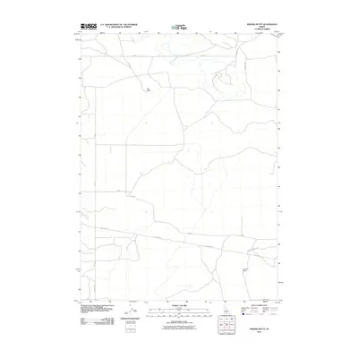
2010 Map of Kimama Butte
USGS Topo · Published 2010About this map
Kimama Butte and Sid Butte define the basalt-strewn landscape of this Jerome County region. The terrain is marked by a deliberate grid of rural roads and infrastructure, including the prominent Pole Line Rd which traverses the southern portion of the quadrangle. This 2010 survey by the U.S. Geological Survey illustrates the intersection of geological landmarks and modern utility corridors. Sparse water features and a network of arterial routes like Senter Rd and Kimama Lookout Rd suggest an area primarily utilized for range management and infrastructure maintenance. The map provides a clear record of the physical geography and the precisely surveyed road system that connects these isolated volcanic buttes to the wider Snake River Plain.
Find a feature on this map
16 named features on this map. Tap any name to fly to it.
Don’t see what you’re looking for? This feature index may not catch every label — zoom into the map to look around manually.
Map Details
Editions of this 2010 Kimama Butte Map
This is the sole edition of this map. No revisions or reprints were ever made.
Other maps of this area

1954 · Pocatello
USGS Topo · 1:250,000

1955 · Twin Falls
USGS Topo · 1:250,000

1958 · Twin Falls
USGS Topo · 1:250,000

1958 · Pocatello
USGS Topo · 1:250,000

1964 · Burley NE
USGS Topo · 1:24,000

1964 · Burley NW
USGS Topo · 1:24,000

1964 · Hazelton NE
USGS Topo · 1:24,000

1971 · Owinza
USGS Topo · 1:24,000
1971 · Owinza Butte
USGS Topo · 1:24,000

1972 · Shale Butte
USGS Topo · 1:24,000