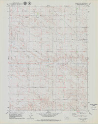
1979 Map of Kimball 2 SW
USGS Topo · Published 1979About this map
Industrial activity and energy infrastructure define the landscape of this high plains region in the late 1970s. The terrain is marked by numerous Oil Wells and isolated Oil Well sites, pointing to the importance of petroleum extraction to the local economy during this era. A significant Pipeline cuts across the northern sections, while multiple Gravel Pits indicate active quarrying operations nearby. In the southern portion of the quadrangle, a prominent Radio Tower stands as a landmark for navigation and communications. This survey provides a clear view of the rural industrial footprint before late-century technological shifts, documenting the specific locations of water wells and energy assets throughout the township and range grid.
Find a feature on this map
8 named features on this map. Tap any name to fly to it.
Don’t see what you’re looking for? This feature index may not catch every label — zoom into the map to look around manually.
Map Details
Editions of this 1979 Kimball 2 SW Map
2 editions found
Other maps of this area

1954 · Scottsbluff
USGS Topo · 1:250,000

1954 · Cheyenne
USGS Topo · 1:250,000

1958 · Cheyenne
USGS Topo · 1:250,000

1958 · Scottsbluff
USGS Topo · 1:250,000

1963 · Pine Bluffs
USGS Topo · 1:24,000

1963 · Lindbergh
USGS Topo · 1:24,000

1968 · Pine Bluffs
USGS Topo · 1:24,000

1972 · Bushnell
USGS Topo · 1:24,000

1972 · Oliver Reservoir
USGS Topo · 1:24,000

1973 · Kimball 2 NE
USGS Topo · 1:24,000