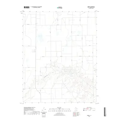
2019 Map of Kimball
USGS Topo · Published 2019About this map
The high plains of Hansford County are defined here by a series of engineered water features and deep drainage channels. Cargill Industries Lake and Millers Lake sit atop the flat plateau, contrasting with the sharp, eroded topography of Farwell Draw that cuts through the southern portion of the quadrangle. This area of the Texas Panhandle remains dominated by agricultural infrastructure and ranching access, evidenced by an extensive grid of county and farm-to-market roads. Near the intersection of FM 278 and the local road network, Gruver Cem serves as a primary point of interest for genealogists and local historians, representing the long-standing community ties in this northern Texas landscape. The ephemeral course of Hackberry Cr winds through the northern section, highlighting the intermittent nature of water in this semi-arid region.
Find a feature on this map
22 named features on this map. Tap any name to fly to it.
Don’t see what you’re looking for? This feature index may not catch every label — zoom into the map to look around manually.
Map Details
Editions of this 2019 Kimball Map
This is the sole edition of this map. No revisions or reprints were ever made.
Other maps of this area

1954 · Perryton
USGS Topo · 1:250,000

1958 · Perryton
USGS Topo · 1:250,000

1962 · Kimball
USGS Topo · 1:24,000

1962 · Hansford Camp
USGS Topo · 1:24,000

1962 · Hansford
USGS Topo · 1:24,000

1962 · Waka SW
USGS Topo · 1:24,000

1962 · Spearman
USGS Topo · 1:24,000

1973 · Gruver
USGS Topo · 1:24,000

1974 · Hannas Draw East
USGS Topo · 1:24,000

1974 · Bernstein
USGS Topo · 1:24,000