
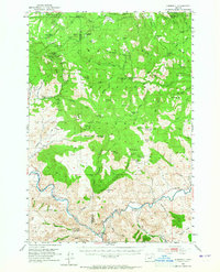
1953 Map of Kimberly
USGS Topo · Published 1955About this map
The John Day River carves a deep path through this high-desert territory, meeting Bologna Creek near the small settlement of Kimberly. This mid-century survey reveals a landscape of isolated peaks and naming conventions that reflect the era, including China Hat Peak and Nigger Knob. The area is defined by its water sources, with numerous springs like Whitetail Spr and Sunflower Spr serving as critical points in the dry terrain.
Find a feature on this map
85 named features on this map. Tap any name to fly to it.
Don’t see what you’re looking for? This feature index may not catch every label — zoom into the map to look around manually.
Map Details
Editions of this 1953 Kimberly Map
2 editions found
Other maps of this area

1951 · Courtrock
USGS Topo · 1:62,500

1951 · Monument
USGS Topo · 1:62,500

1953 · Richmond
USGS Topo · 1:62,500

1953 · Picture
USGS Topo · 1:62,500

1953 · Spray
USGS Topo · 1:62,500

1953 · Pendleton
USGS Topo · 1:250,000

1955 · Canyon City
USGS Topo · 1:250,000

1956 · Pendleton
USGS Topo · 1:250,000

1959 · Canyon City
USGS Topo · 1:250,000

1969 · Lefevre Prairie
USGS Topo · 1:24,000