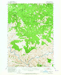
1953 Map of Kimberly
USGS Topo · Published 1965About this map
Kimberly sits at the confluence of several drainages in this mid-century survey of the Oregon high country, where the landscape is defined by the transition from river valleys to the high plateaus of the Umatilla National Forest. The map documents a rugged interior network of springs and camps essential for range management, such as the Bull Prairie Guard Sta and Blue Spruce Camp. To the north, the terrain rises toward Sunflower Flats and Wilson Prairie, while the southern portion is dominated by prominent landmarks like China Hat Peak and Nigger Knob. Local history is anchored by early settlements and family-named landmarks, including the isolated Haystack Cem and the former post office at Colvin. The presence of the CCC Spr Trail reflects the legacy of public works projects in shaping access to these timberlands and grazing allotments.
Find a feature on this map
71 named features on this map. Tap any name to fly to it.
Don’t see what you’re looking for? This feature index may not catch every label — zoom into the map to look around manually.
Map Details
Editions of this 1953 Kimberly Map
2 editions found
Other maps of this area

1951 · Courtrock
USGS Topo · 1:62,500

1951 · Monument
USGS Topo · 1:62,500

1953 · Richmond
USGS Topo · 1:62,500

1953 · Kimberly
USGS Topo · 1:62,500

1953 · Picture
USGS Topo · 1:62,500

1953 · Spray
USGS Topo · 1:62,500

1953 · Pendleton
USGS Topo · 1:250,000

1955 · Canyon City
USGS Topo · 1:250,000

1956 · Pendleton
USGS Topo · 1:250,000

1959 · Canyon City
USGS Topo · 1:250,000