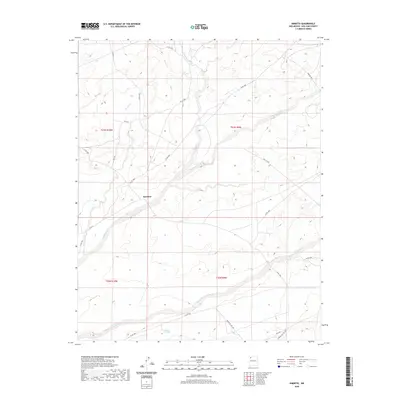
2020 Map of Kimbeto
USGS Topo · Published 2020About this map
Kimbeto serves as the central settlement in this high-desert region of the Eastern Navajo Agency, situated at the junction of several critical access routes. The landscape is defined by the significant drainage systems of Kimbeto Wash and Betonnie Tsosie Wash, which carve through the arid terrain. Infrastructure in the area is largely geared toward utility and local transport, characterized by numerous county roads and dedicated corridors such as Pipeline Rd. Small-scale water management is evident at Hollow Pit Tank, reflecting the necessity of water storage in this environment. The presence of Indian Svc Rte 45E and Indian Svc Rte 456 highlights the network of Bureau of Indian Affairs service routes that connect the scattered residences and grazing lands across the San Juan County landscape.
Find a feature on this map
25 named features on this map. Tap any name to fly to it.
Don’t see what you’re looking for? This feature index may not catch every label — zoom into the map to look around manually.
Map Details
Editions of this 2020 Kimbeto Map
This is the sole edition of this map. No revisions or reprints were ever made.
Other maps of this area

1889 · Largo
USGS Topo · 1:250,000

1895 · Largo
USGS Topo · 1:250,000

1954 · Aztec
USGS Topo · 1:250,000

1958 · Aztec
USGS Topo · 1:250,000

1959 · Nageezi
USGS Topo · 1:62,500

1962 · Aztec
USGS Topo · 1:250,000

1965 · Aztec
USGS Topo · 1:250,000
1966 · Pueblo Bonito
USGS Topo · 1:24,000
1966 · Pueblo Bonito NW
USGS Topo · 1:24,000

1966 · Lybrook NW
USGS Topo · 1:24,000