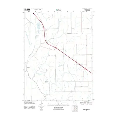
2012 Map of Kimsey Creek
USGS Topo · Published 2012About this map
Baldwin Cemetery and South Bethel Cemetery sit among the headwaters of the Missouri River valley, overlooking a landscape defined by an intricate network of drainage creeks. This rural portion of Holt County is dominated by the course of Kimsey Creek and Blair Creek, which cut through the agricultural tablelands. The map reveals the persistence of family-centered landmarks in the Missouri countryside, including Boyd Cemetery and Roderick Cemetery. Notable water features like Bluff Pool and Gordan Lake provide localized contrast to the sprawling grid of county roads. The transport network is anchored by a major arterial route crossing diagonally, intersecting with local ways such as State St and Omaha Rd, which connect these small, ancestral burial grounds and farmsteads.
Find a feature on this map
62 named features on this map. Tap any name to fly to it.
Don’t see what you’re looking for? This feature index may not catch every label — zoom into the map to look around manually.
Map Details
Editions of this 2012 Kimsey Creek Map
This is the sole edition of this map. No revisions or reprints were ever made.
Other maps of this area

1885 · Atchison
USGS Topo · 1:125,000

1888 · Atchison
USGS Topo · 1:125,000

1893 · Atchison
USGS Topo · 1:125,000

1920 · Craig
USGS Topo · 1:62,500

1926 · Oregon
USGS Topo · 1:62,500

1926 · Maitland
USGS Topo · 1:62,500

1950 · Kansas City
USGS Topo · 1:250,000

1954 · Kansas City
USGS Topo · 1:250,000

1955 · Nebraska City
USGS Topo · 1:250,000

1956 · Kansas City
USGS Topo · 1:250,000