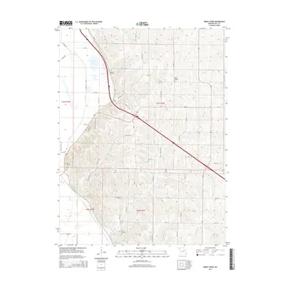
2015 Map of Kimsey Creek
USGS Topo · Published 2015About this map
The rolling loess hills of Holt County define this landscape, where the waters of Kimsey Creek and Blair Cr carve through the agricultural uplands. This 2015 study documents a territory characterized by family-named landmarks and a legacy of early settlement. Several historic burial grounds are preserved across the sections, including Baldwin Cemetery, South Bethel Cemetery, and Roderick Cemetery, providing vital touchpoints for genealogical research. The western edge of the map features a distinct transition toward the Missouri River floodplain, marked by several bodies of water such as John Hall Lake, Gordan Lake, and the managed Bluff Pool. Recreational and historical paths like the Munkers Homestead Trail and the Callow Memorial Trail Loess Bluff Trail wind through the hills, following the unique topography of the bluff line. The infrastructure is a grid of rural routes like Lone Elm Rd and Nickle Rd, maintaining the township and range organization of the Missouri countryside.
Find a feature on this map
56 named features on this map. Tap any name to fly to it.
Don’t see what you’re looking for? This feature index may not catch every label — zoom into the map to look around manually.
Map Details
Editions of this 2015 Kimsey Creek Map
This is the sole edition of this map. No revisions or reprints were ever made.
Other maps of this area

1885 · Atchison
USGS Topo · 1:125,000

1888 · Atchison
USGS Topo · 1:125,000

1893 · Atchison
USGS Topo · 1:125,000

1920 · Craig
USGS Topo · 1:62,500

1926 · Oregon
USGS Topo · 1:62,500

1926 · Maitland
USGS Topo · 1:62,500

1950 · Kansas City
USGS Topo · 1:250,000

1954 · Kansas City
USGS Topo · 1:250,000

1955 · Nebraska City
USGS Topo · 1:250,000

1956 · Kansas City
USGS Topo · 1:250,000