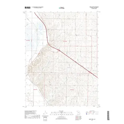
2017 Map of Kimsey Creek
USGS Topo · Published 2017About this map
The low-lying wetlands and creek beds of rural Holt County define this landscape, where the waters of Bluff Pool and Gordan Lake sit alongside the winding path of Kimsey Cr. The terrain is marked by a network of drainage features including Swope Cr, Blair Cr, and Davis Cr, which cut through the agricultural sections of the county. A grid of rural routes such as Lone Elm RD and State HWY BB connects the various family and community burial grounds that anchor the local geography. These sites, including South Bethel Cem and Baldwin Cem, offer significant points of interest for those researching the lineage and settlement patterns of this Missouri region. The interplay between the natural water systems and the established road network reveals a community built around the challenges and resources of the local river-and-creek topography.
Find a feature on this map
53 named features on this map. Tap any name to fly to it.
Don’t see what you’re looking for? This feature index may not catch every label — zoom into the map to look around manually.
Map Details
Editions of this 2017 Kimsey Creek Map
This is the sole edition of this map. No revisions or reprints were ever made.
Other maps of this area

1885 · Atchison
USGS Topo · 1:125,000

1888 · Atchison
USGS Topo · 1:125,000

1893 · Atchison
USGS Topo · 1:125,000

1920 · Craig
USGS Topo · 1:62,500

1926 · Oregon
USGS Topo · 1:62,500

1926 · Maitland
USGS Topo · 1:62,500

1950 · Kansas City
USGS Topo · 1:250,000

1954 · Kansas City
USGS Topo · 1:250,000

1955 · Nebraska City
USGS Topo · 1:250,000

1956 · Kansas City
USGS Topo · 1:250,000