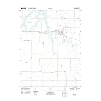
2012 Map of Kincaid
USGS Topo · Published 2012About this map
The Kincaid Consolidated Oil Field defines much of the industrial character in this portion of Christian County, situated just north of the village of Kincaid. This landscape reflects a dense network of rural roads and established settlements, including Tovey, Bulpitt, and Jeisyville, which are clustered along the east-west corridor of Taylorville Rd. To the west, the expansive waters of Sangchris Lake and the protected lands of Sangchris Lake State Park offer a contrast to the agricultural and energy-producing interior.
Find a feature on this map
82 named features on this map. Tap any name to fly to it.
Don’t see what you’re looking for? This feature index may not catch every label — zoom into the map to look around manually.
Map Details
Editions of this 2012 Kincaid Map
This is the sole edition of this map. No revisions or reprints were ever made.
Other maps of this area

1922 · Divernon
USGS Topo · 1:62,500

1923 · Taylorville
USGS Topo · 1:62,500

1923 · Raymond
USGS Topo · 1:62,500

1924 · Divernon
USGS Topo · 1:62,500

1925 · Taylorville
USGS Topo · 1:62,500

1925 · Raymond
USGS Topo · 1:62,500

1946 · Nokomis
USGS Topo · 1:62,500

1949 · Nokomis
USGS Topo · 1:62,500

1958 · Decatur
USGS Topo · 1:250,000
1961 · New City
USGS Topo · 1:24,000