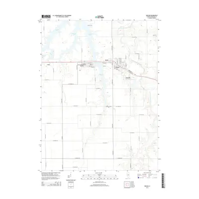
2015 Map of Kincaid
USGS Topo · Published 2015About this map
Sangchris Lake and its intricate northern inlets dominate the landscape of central Illinois in Christian County. This survey illustrates a cluster of small settlements including Kincaid, Tovey, and Bulpitt, which are linked by a network of local roads such as Midland Blvd and Mason St. The area's agricultural and rural character is evidenced by the numerous section roads and the presence of several small burial grounds, including the Achenback Lutheran Cem and Goode Cem. The South Fork Sangamon River meanders through the northeast corner, providing a natural contrast to the geometric grid of the surrounding farmland. Further south, Clear Cr and Bear Cr drain the open country, while the community of Jeisyville sits near the eastern edge. The detailed street layout of these villages, including Tovey Humphrey Station, offers a clear view of the residential patterns that have persisted in this coal-mining region.
Find a feature on this map
60 named features on this map. Tap any name to fly to it.
Don’t see what you’re looking for? This feature index may not catch every label — zoom into the map to look around manually.
Map Details
Editions of this 2015 Kincaid Map
This is the sole edition of this map. No revisions or reprints were ever made.
Other maps of this area

1922 · Divernon
USGS Topo · 1:62,500

1923 · Taylorville
USGS Topo · 1:62,500

1923 · Raymond
USGS Topo · 1:62,500

1924 · Divernon
USGS Topo · 1:62,500

1925 · Taylorville
USGS Topo · 1:62,500

1925 · Raymond
USGS Topo · 1:62,500

1946 · Nokomis
USGS Topo · 1:62,500

1949 · Nokomis
USGS Topo · 1:62,500

1958 · Decatur
USGS Topo · 1:250,000
1961 · New City
USGS Topo · 1:24,000