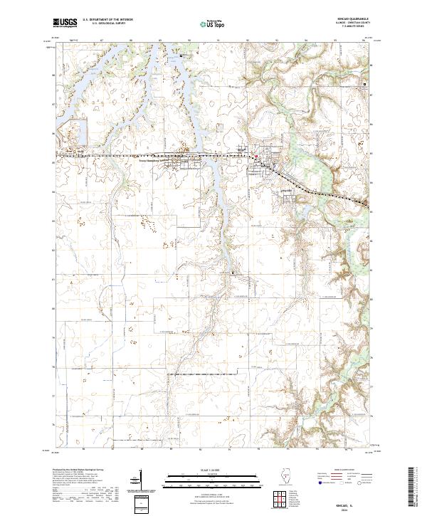
2024 Map of Kincaid
USGS Topo · Published 2024About this map
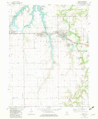
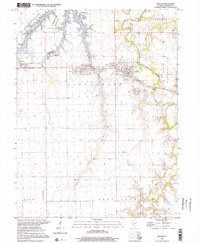
Kincaid and its neighboring coal-country settlements define this landscape in Christian County, where the industrial legacy of the Taylorville area meets the waters of Sangchris Lake. The map reveals a tight cluster of residential grids including Bulpitt, Tovey, and Jeisyville, reflecting the region's dense development around historical mining and transportation hubs like Tovey Humphrey Station. Outside these compact towns, the terrain transitions into a structured grid of county roads, such as Co RD 1800 N, which connect family-history sites like Bethany Cem and Walnut Hill Cem. The southern reach of Sangchris Lake and the winding South Fork Sangamon River provide natural boundaries to the agricultural fields, while smaller drainages like Clear Creek and Bear Creek cut through the central plains. This modern survey is an essential tool for identifying the persistent footprints of these small Illinois towns and their local landmarks.
Find a feature on this map
68 named features on this map. Tap any name to fly to it.
Don’t see what you’re looking for? This feature index may not catch every label — zoom into the map to look around manually.
Map Details
Editions of this 2024 Kincaid Map
This is the sole edition of this map. No revisions or reprints were ever made.
Historical Maps of Tovey Humphrey Station Through Time
3 maps found