
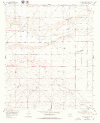
1955 Map of Kincaid Ranch
USGS Topo · Published 1956About this map
Rio Felix winds through the heart of this Chaves County landscape, defining a region of remote cattle operations and intermittent water sources. The map captures a high-desert ranching economy in the mid-1950s, centered on established outposts like Price Ranch and Kincaid Ranch. Land use is dictated by the availability of water, shown through the network of Windmills and human-made improvements such as Made Tank and a Ditch system near the river.
Find a feature on this map
18 named features on this map. Tap any name to fly to it.
Don’t see what you’re looking for? This feature index may not catch every label — zoom into the map to look around manually.
Map Details
Editions of this 1955 Kincaid Ranch Map
This is the sole edition of this map. No revisions or reprints were ever made.
Other maps of this area

1949 · Peters Lake
USGS Topo · 1:24,000

1949 · Juan Lake
USGS Topo · 1:24,000

1954 · Carlsbad
USGS Topo · 1:250,000

1955 · Hope NW
USGS Topo · 1:24,000

1955 · Hackberry Ranch
USGS Topo · 1:24,000

1955 · Hope NE
USGS Topo · 1:24,000

1955 · Roswell
USGS Topo · 1:250,000

1958 · Carlsbad
USGS Topo · 1:250,000

1958 · Roswell
USGS Topo · 1:250,000
1959 · Hackberry Ranch
USGS Topo · 1:24,000