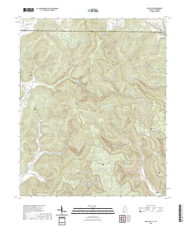
2024 Map of King Cove
USGS Topo · Published 2024About this map
Francisco sits at the northeastern corner of this map, marking a rare point of concentration in a landscape defined by sharp elevation changes and deep coves. The terrain is divided by several significant peaks, including Hale Mtn and Maxwell Mtn, which create natural boundaries between the drainage basins of the Jenny River and the Hurricane Creek system. Family history is etched into the topography through a high density of small burial grounds, such as Beech Grove Cem and Hudson Cem, often located on higher ground near the heads of coves like Puncheon Cove or King Cove. The intricate network of limestone features, evidenced by Hambrick Sinks and Bucky Sink, suggests a complex subterranean hydrology characteristic of the region where the Tennessee and Alabama state line meets the junction of Madison Co, Jackson Co, and Franklin Co.
Find a feature on this map
87 named features on this map. Tap any name to fly to it.
Don’t see what you’re looking for? This feature index may not catch every label — zoom into the map to look around manually.
Map Details
Editions of this 2024 King Cove Map
This is the sole edition of this map. No revisions or reprints were ever made.
Other maps of this area

1888 · Scottsboro
USGS Topo · 1:125,000

1892 · Scottsboro
USGS Topo · 1:125,000

1928 · Decherd
USGS Topo · 1:62,500

1936 · King Cove
USGS Topo · 1:24,000

1936 · Flintville
USGS Topo · 1:24,000

1936 · Hollytree
USGS Topo · 1:24,000

1936 · Beans Creek
USGS Topo · 1:24,000

1936 · Princeton
USGS Topo · 1:24,000

1936 · Huntland
USGS Topo · 1:24,000

1936 · Maysville
USGS Topo · 1:24,000