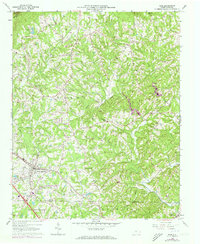
1964 Map of King
USGS Topo · Published 1973About this map
King serves as a central hub in this landscape where the Southern railroad line cuts through the foothills of the Sauratown Mountains. The map reveals a transition from the developing residential patterns of Trailer Park and Bannertown to the more dispersed rural settlements of Capella and Quaker Gap. Near the southern border, the historical districts of Old Richmond and Bethania reflect deep-rooted local history, while the rugged northern terrain is defined by Sauratown Mtn and the presence of Camp Hanes.
Find a feature on this map
49 named features on this map. Tap any name to fly to it.
Don’t see what you’re looking for? This feature index may not catch every label — zoom into the map to look around manually.
Map Details
Editions of this 1964 King Map
3 editions found
Other maps of this area

1951 · Rural Hall
USGS Topo · 1:24,000

1951 · Walkertown
USGS Topo · 1:24,000

1953 · Winston-Salem
USGS Topo · 1:250,000

1955 · Winston-Salem
USGS Topo · 1:250,000

1962 · Winston-Salem
USGS Topo · 1:250,000

1964 · Hanging Rock
USGS Topo · 1:24,000

1964 · Pinnacle
USGS Topo · 1:24,000

1964 · King
USGS Topo · 1:24,000

1964 · Pilot Mountain
USGS Topo · 1:24,000
1968 · Vienna
USGS Topo · 1:24,000