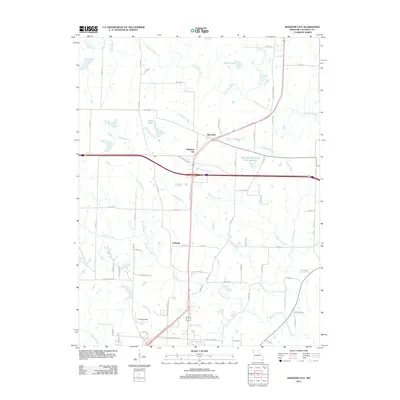
2012 Map of Kingdom City
USGS Topo · Published 2012About this map
Kingdom City serves as the central hub of this 2012 survey, situated at a major crossroads in Callaway County. The landscape is defined by its extensive network of watercourses, including the winding Auxvasse Creek to the north and Richland Creek to the south. Small settlements like McCredie and Callaway are connected by a web of rural routes such as State Rd FF and Old US Highway 40, reflecting the region's agricultural and transit-oriented character.
Find a feature on this map
76 named features on this map. Tap any name to fly to it.
Don’t see what you’re looking for? This feature index may not catch every label — zoom into the map to look around manually.
Map Details
Editions of this 2012 Kingdom City Map
This is the sole edition of this map. No revisions or reprints were ever made.
Other maps of this area

1886 · Jefferson City
USGS Topo · 1:125,000

1890 · Mexico
USGS Topo · 1:125,000

1890 · Moberly
USGS Topo · 1:125,000

1890 · Fulton
USGS Topo · 1:125,000

1894 · Jefferson City
USGS Topo · 1:125,000

1928 · Fulton
USGS Topo · 1:62,500

1931 · Fulton
USGS Topo · 1:62,500

1932 · Mexico
USGS Topo · 1:62,500

1944 · Millersburg
USGS Topo · 1:62,500

1945 · Centralia
USGS Topo · 1:62,500