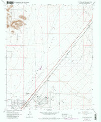
1968 Map of Kingman Airport
USGS Topo · Published 1980About this map
Kingman Airport serves as a central hub in this high-desert landscape, illustrating the infrastructure of Mohave County during the late 1960s. The site is a complex of aviation and utility facilities, including a Radio Facility and a Fire Sta, surrounded by a burgeoning street grid that includes Thompson Avenue and Northern Avenue. The heavy rail influence of the Atchison Topeka and Santa Fe railroad cuts diagonally across the Hualapai Valley, marking the primary transportation artery through the region.
Find a feature on this map
21 named features on this map. Tap any name to fly to it.
Don’t see what you’re looking for? This feature index may not catch every label — zoom into the map to look around manually.
Map Details
Editions of this 1968 Kingman Airport Map
3 editions found
Other maps of this area

1886 · Diamond Creek
USGS Topo · 1:250,000

1886 · Camp Mohave
USGS Topo · 1:250,000

1892 · Diamond Creek
USGS Topo · 1:250,000

1892 · Camp Mohave
USGS Topo · 1:250,000

1939 · Chloride
USGS Topo · 1:48,000

1942 · Camp Mohave
USGS Topo · 1:250,000

1944 · Chloride
USGS Topo · 1:62,500

1947 · Kingman
USGS Topo · 1:250,000

1948 · Kingman
USGS Topo · 1:250,000

1948 · Williams
USGS Topo · 1:250,000