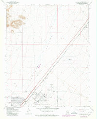
1968 Map of Kingman Airport
USGS Topo · Published 1980About this map
Kingman Airport and the expansive Hualapai Valley define this late-1960s landscape, illustrating the intersection of transportation and ranching in Mohave County. The map documents the vital Atchison Topeka and Santa Fe railroad corridor as it cuts through the valley floor, connecting the settlement of Berry with the various districts of Walapai. These communities are shown alongside critical infrastructure like a Radio Facility, a Sewage Disposal site, and the local Fire Station, providing a detailed look at the area's mid-century development.
Find a feature on this map
23 named features on this map. Tap any name to fly to it.
Don’t see what you’re looking for? This feature index may not catch every label — zoom into the map to look around manually.
Map Details
Editions of this 1968 Kingman Airport Map
3 editions found
Other maps of this area

1886 · Diamond Creek
USGS Topo · 1:250,000

1886 · Camp Mohave
USGS Topo · 1:250,000

1892 · Diamond Creek
USGS Topo · 1:250,000

1892 · Camp Mohave
USGS Topo · 1:250,000

1939 · Chloride
USGS Topo · 1:48,000

1942 · Camp Mohave
USGS Topo · 1:250,000

1944 · Chloride
USGS Topo · 1:62,500

1947 · Kingman
USGS Topo · 1:250,000

1948 · Kingman
USGS Topo · 1:250,000

1948 · Williams
USGS Topo · 1:250,000