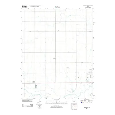
2009 Map of Kingman NW
USGS Topo · Published 2009About this map
Hoosier Cemetery stands as a focal point for genealogical interest in this rural landscape northwest of the Kingman community. The area is defined by its agrarian structure, with a rigid grid of section roads including Maple Grove Rd and NW 40 St cutting across the terrain. These routes link small clusters of activity like Browns Spur, reflecting the late-era development of the Kansas wheat belt. The southern portion of the quadrangle is shaped by the winding path of the South Fork Ninnescah River, which is joined by Petut Creek. This drainage system provides a natural contrast to the geometric precision of the surrounding farmland. Significant transit through the region is anchored by US Hwy 54, which runs east-to-west, serving as a primary corridor for the county's agricultural commerce.
Find a feature on this map
27 named features on this map. Tap any name to fly to it.
Don’t see what you’re looking for? This feature index may not catch every label — zoom into the map to look around manually.
Map Details
Editions of this 2009 Kingman NW Map
This is the sole edition of this map. No revisions or reprints were ever made.
Other maps of this area

1892 · Kingman
USGS Topo · 1:125,000

1894 · Kingman
USGS Topo · 1:125,000

1955 · Pratt
USGS Topo · 1:250,000

1959 · Pratt
USGS Topo · 1:250,000

1967 · Kingman NW
USGS Topo · 1:24,000
1967 · Alameda
USGS Topo · 1:24,000

1967 · Cleveland
USGS Topo · 1:24,000
1967 · Kingman
USGS Topo · 1:24,000
1967 · Willowdale
USGS Topo · 1:24,000

1967 · Penalosa
USGS Topo · 1:24,000