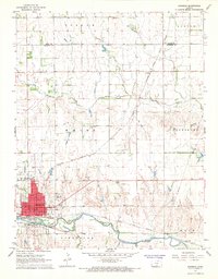
1967 Map of Kingman
USGS Topo · Published 1968About this map
Kingman serves as the regional hub for this mid-century survey, its grid reaching toward the South Fork Ninnescah River. The town's infrastructure is well-established, featuring the Kingman Municipal Airport, a Courthouse, and the County Fairground on the southern edge. The influence of the Atchison Topeka and Santa Fe railroad is prominent, with lines converging at the city center and passing through the small settlement of Varner to the northeast. Beyond the urban core, the landscape transitions into agricultural townships like White and Galesburg, where land use is marked by several Oil Wells, a Drive-in Theater, and family-named sites such as Schooley Cemetery. The network of Smoots Creek and Negro Creek provides natural drainage across the terrain, reflecting the area's transition from river-valley settlement to a diverse rural economy involving ranching, energy extraction, and transit.
Find a feature on this map
35 named features on this map. Tap any name to fly to it.
Don’t see what you’re looking for? This feature index may not catch every label — zoom into the map to look around manually.
Map Details
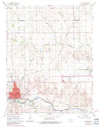
Editions of this 1967 Kingman Map
2 editions found
Other maps of this area

1889 · Cheney
USGS Topo · 1:125,000

1891 · Cheney
USGS Topo · 1:125,000

1892 · Kingman
USGS Topo · 1:125,000

1894 · Kingman
USGS Topo · 1:125,000

1901 · Cheney
USGS Topo · 1:125,000

1955 · Wichita
USGS Topo · 1:250,000

1955 · Pratt
USGS Topo · 1:250,000

1958 · Wichita
USGS Topo · 1:250,000

1959 · Pratt
USGS Topo · 1:250,000
1965 · Waterloo
USGS Topo · 1:24,000