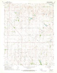
1967 Map of Alameda
USGS Topo · Published 1968About this map
The agrarian landscape of Kingman County is defined by the development of the Alameda Oil and Gas Field and the Basil Oil and Gas Field. These energy resources sit alongside established rail infrastructure, notably the Atchison Topeka and Santa Fe Pacific line that bisects the region. The small settlements of Alameda and Basil serve as local anchors, while community life is visible through landmarks such as the Forest Home Grange Hall and Bethany Ch.
Find a feature on this map
20 named features on this map. Tap any name to fly to it.
Don’t see what you’re looking for? This feature index may not catch every label — zoom into the map to look around manually.
Map Details
Editions of this 1967 Alameda Map
This is the sole edition of this map. No revisions or reprints were ever made.
Other maps of this area

1889 · Anthony
USGS Topo · 1:125,000

1889 · Cheney
USGS Topo · 1:125,000

1889 · Caldwell
USGS Topo · 1:125,000

1891 · Cheney
USGS Topo · 1:125,000

1891 · Anthony
USGS Topo · 1:125,000

1892 · Kingman
USGS Topo · 1:125,000

1893 · Caldwell
USGS Topo · 1:125,000

1894 · Kingman
USGS Topo · 1:125,000

1897 · Caldwell
USGS Topo · 1:125,000

1901 · Cheney
USGS Topo · 1:125,000