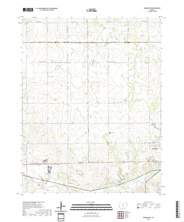
2022 Map of Kingman NW
USGS Topo · Published 2022About this map
The town of Kingman and its agricultural surroundings define this landscape along the South Fork Ninnescah River. Aviation history is present at the Kingman Airport/Clyde Cessna Field, a notable landmark east of the rural plains. The terrain is marked by the drainage patterns of Smoots Cr and Petut Cr, which carve through the gridded section lines of the Public Land Survey System.
Find a feature on this map
31 named features on this map. Tap any name to fly to it.
Don’t see what you’re looking for? This feature index may not catch every label — zoom into the map to look around manually.
Map Details
Editions of this 2022 Kingman NW Map
This is the sole edition of this map. No revisions or reprints were ever made.
Other maps of this area

1892 · Kingman
USGS Topo · 1:125,000

1894 · Kingman
USGS Topo · 1:125,000

1955 · Pratt
USGS Topo · 1:250,000

1959 · Pratt
USGS Topo · 1:250,000

1967 · Kingman NW
USGS Topo · 1:24,000
1967 · Alameda
USGS Topo · 1:24,000

1967 · Cleveland
USGS Topo · 1:24,000
1967 · Kingman
USGS Topo · 1:24,000
1967 · Willowdale
USGS Topo · 1:24,000

1967 · Penalosa
USGS Topo · 1:24,000