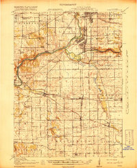
1918 Map of Kings
USGS Topo · Published 1918About this map
Camp Grant dominates the northeastern corner of this 1917 survey, reflecting the military buildup during the First World War. The facility includes specialized infrastructure like the Rifle Range and its own Camp Grant Sta, emphasizing the site's role as a major training cantonment. The surrounding landscape in northern Illinois is a dense network of steam and electric transit, featuring lines like the Rockford and Interurban Electric Ry and the Chicago Milwaukee and St Paul RR.
Find a feature on this map
76 named features on this map. Tap any name to fly to it.
Don’t see what you’re looking for? This feature index may not catch every label — zoom into the map to look around manually.
Map Details
Editions of this 1918 Kings Map
3 editions found
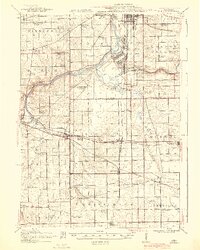
Other maps of this area

1917 · Kings
USGS Topo · 1:62,500

1918 · Rockford
USGS Topo · 1:62,500

1918 · Belvidere
USGS Topo · 1:62,500

1918 · Dixon
USGS Topo · 1:62,500

1918 · Kings
USGS Topo · 1:62,500

1918 · Kirkland
USGS Topo · 1:62,500

1922 · Oregon
USGS Topo · 1:62,500

1924 · Oregon
USGS Topo · 1:62,500

1932 · Pecatonica
USGS Topo · 1:62,500

1934 · De Kalb
USGS Topo · 1:62,500