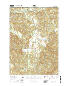
2017 Map of Kings Valley
USGS Topo · Published 2017About this map
Kings Valley and Hoskins anchor this rural landscape along the upper reaches of the Luckiamute River in the mid-2010s. The area is notable for its concentration of family and pioneer burial grounds, including the Edwards Pioneer Cem, Pedee Cem, Womer Cem, and Kings Valley Cem. These sites, along with the landmark Fort Hoskins (Spring), indicate a long history of settlement and community along the valley floor. The topography is defined by significant ridges and hills like Dunn Ridge, Bonner Mtn, and the Cardwell Hills, which separate the various drainage basins of Ritner Cr and Maxfield Cr. Several man-made water features, such as Mitchell Reservoir, Emory Moore Reservoir, and the evocatively named Lake of the Winds, suggest the managed nature of the local watershed for agricultural or residential use.
Find a feature on this map
72 named features on this map. Tap any name to fly to it.
Don’t see what you’re looking for? This feature index may not catch every label — zoom into the map to look around manually.
Map Details
Editions of this 2017 Kings Valley Map
This is the sole edition of this map. No revisions or reprints were ever made.
Other maps of this area

1913 · Philomath
USGS Topo · 1:31,680

1914 · Soap Creek
USGS Topo · 1:31,680

1921 · Corvallis
USGS Topo · 1:62,500

1922 · Airlie
USGS Topo · 1:31,680

1939 · Marys Peak
USGS Topo · 1:62,500

1942 · Marys Peak
USGS Topo · 1:62,500

1942 · Corvallis
USGS Topo · 1:62,500

1942 · Valsetz
USGS Topo · 1:62,500

1942 · Dallas
USGS Topo · 1:62,500

1953 · Salem
USGS Topo · 1:250,000