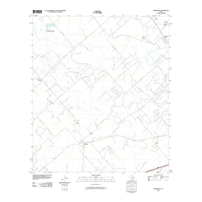
2010 Map of Kingsbury
USGS Topo · Published 2010About this map
Kingsbury anchors the southern portion of this landscape, situated at a junction of regional routes and local farm-to-market roads. The terrain is defined by a dendritic network of drainages including Brushy Creek and York Creek, which feed toward the San Marcos River in the northeast near Prairie Lea. The settlement pattern is characterized by family-named landmarks and historical burial grounds, such as Happle Cemetery and Pentress Cemetery, reflecting the long-established agricultural community of this part of Texas. Evidence of early 21st-century water management is visible through the Baker Lake Dam and the Soil Conservation Service Site 16 Reservoir. Moving west toward the Mill Creek Hills, the map shows a shift toward more varied elevation near the small community of Weinert, with numerous ranch roads like Gravel Pit Rd and Munk Rd connecting the dispersed rural homesteads.
Find a feature on this map
57 named features on this map. Tap any name to fly to it.
Don’t see what you’re looking for? This feature index may not catch every label — zoom into the map to look around manually.
Map Details
Editions of this 2010 Kingsbury Map
This is the sole edition of this map. No revisions or reprints were ever made.
Other maps of this area

1911 · San Marcos
USGS Topo · 1:125,000

1919 · San Marcos
USGS Topo · 1:125,000

1924 · San Marcos 3-c
USGS Topo · 1:48,000

1924 · San Marcos 3-d
USGS Topo · 1:48,000

1925 · San Marcos 4-c
USGS Topo · 1:48,000

1929 · Luling
USGS Topo · 1:62,500

1930 · Lockhart
USGS Topo · 1:62,500

1930 · Seguin
USGS Topo · 1:62,500

1953 · Seguin
USGS Topo · 1:250,000

1958 · Seguin
USGS Topo · 1:250,000