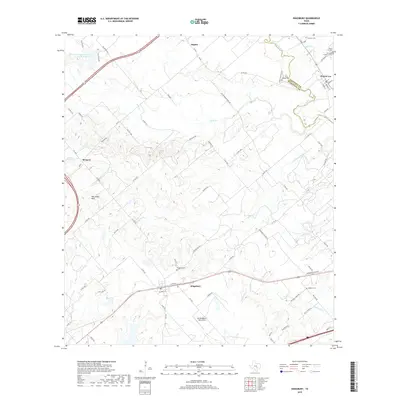
2019 Map of Kingsbury
USGS Topo · Published 2019About this map
The San Marcos River forms the natural boundary between Caldwell and Guadalupe counties, anchoring a landscape defined by small agrarian settlements and scattered family history. In the south, Kingsbury sits at a crossroads of ranch roads and historic flight history, home to the Old Kingsbury Aerodrome. The surrounding terrain is marked by the Mill Creek Hills and the prominent Wilkes Hill, with water drainage flowing through tributaries like York Cr and Brushy Cr. For genealogists, the map is remarkably dense with burial sites, including the Kingsbury Cem, Appling Cem, and several smaller grounds near Prairie Lea. This 2019 survey captures the modern road network, from FM 20 to numerous county roads, while preserving the spatial relationship between legacy land tracts and the waterways that once shaped early Texas settlement patterns in this corridor.
Find a feature on this map
78 named features on this map. Tap any name to fly to it.
Don’t see what you’re looking for? This feature index may not catch every label — zoom into the map to look around manually.
Map Details
Editions of this 2019 Kingsbury Map
This is the sole edition of this map. No revisions or reprints were ever made.
Other maps of this area

1911 · San Marcos
USGS Topo · 1:125,000

1919 · San Marcos
USGS Topo · 1:125,000

1924 · San Marcos 3-c
USGS Topo · 1:48,000

1924 · San Marcos 3-d
USGS Topo · 1:48,000

1925 · San Marcos 4-c
USGS Topo · 1:48,000

1929 · Luling
USGS Topo · 1:62,500

1930 · Lockhart
USGS Topo · 1:62,500

1930 · Seguin
USGS Topo · 1:62,500

1953 · Seguin
USGS Topo · 1:250,000

1958 · Seguin
USGS Topo · 1:250,000