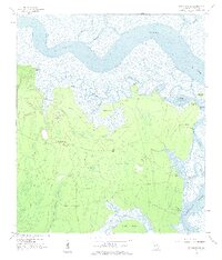
1958 Map of Kingsland NE
USGS Topo · Published 1959About this map
The Satilla River and Cumberland River define this coastal Georgia landscape, where tidal marshes and dense swamps create a complex network of waterways. The 1950s terrain is marked by isolated points of high ground and named bluffs, such as Horsepen Bluff and Cabin Bluff, which served as critical access points for the region's maritime activity. In the interior, the settlement of Forestview stands out near a Lookout Tower, surrounded by expansive wetlands like Barrel Head Swamp and Hermitage Swamp. This survey illustrates the intricate nature of the lowcountry prior to significant modern development, with travel largely restricted to private roads and the Intracoastal Waterway. Genealogists may find value in the location of the Fairfield Cem near Fairfield Point, as well as the various artesian wells dotted across the coastal flats.
Find a feature on this map
39 named features on this map. Tap any name to fly to it.
Don’t see what you’re looking for? This feature index may not catch every label — zoom into the map to look around manually.
Map Details
Editions of this 1958 Kingsland NE Map
2 editions found
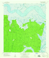
Other maps of this area

1918 · Cumberland Island
USGS Topo · 1:62,500

1918 · Bladen
USGS Topo · 1:62,500

1918 · Kingsland
USGS Topo · 1:62,500

1930 · Cumberland Island
USGS Topo · 1:62,500

1939 · Bladen
USGS Topo · 1:62,500

1945 · Brunswick
USGS Topo · 1:62,500

1945 · Cumberland Island
USGS Topo · 1:62,500

1946 · Brunswick
USGS Topo · 1:250,000

1948 · Jacksonville
USGS Topo · 1:250,000

1948 · Brunswick
USGS Topo · 1:250,000