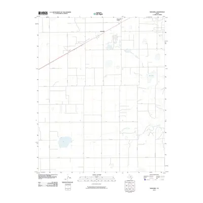
2010 Map of Kingsmill
USGS Topo · Published 2010About this map
The High Plains landscape of Gray County is defined here by a rigorous grid of section-line roads and the winding path of the North Fork Red River. Centered on the community of Kingsmill, the map shows a region of steady agricultural and industrial activity. North of the main settlement lies Kingsmill Camp, a site connected to the regional energy infrastructure of the Texas Panhandle. The topography is relatively flat, punctuated by scattered depressions and small water bodies such as Bell Lake. A dense network of rural routes, including Davis Rd, O'Neal Rd, and Boydston Rd, provides a detailed look at the rural property divisions and access points that have sustained this ranching and farming territory for generations.
Find a feature on this map
28 named features on this map. Tap any name to fly to it.
Don’t see what you’re looking for? This feature index may not catch every label — zoom into the map to look around manually.
Map Details
Editions of this 2010 Kingsmill Map
This is the sole edition of this map. No revisions or reprints were ever made.
Other maps of this area

1954 · Amarillo
USGS Topo · 1:250,000

1958 · Amarillo
USGS Topo · 1:250,000

1963 · Pampa
USGS Topo · 1:24,000

1963 · Skellytown
USGS Topo · 1:24,000

1965 · White Deer
USGS Topo · 1:24,000

1965 · Lake Mc Connell
USGS Topo · 1:24,000

1966 · Grandview School
USGS Topo · 1:24,000

1966 · White Deer SW
USGS Topo · 1:24,000

1966 · Kingsmill
USGS Topo · 1:24,000

1966 · Bowers City
USGS Topo · 1:24,000