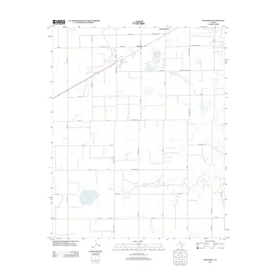
2012 Map of Kingsmill
USGS Topo · Published 2012About this map
Kingsmill and Kingsmill Camp anchor this section of the Texas Panhandle, where the high plains are carved by the headwaters of the N Fork Red River. The landscape is defined by a rigorous grid of section lines and rural routes, many bearing the names of local families and legacy ranching operations. Notable among these are Webster Duncan Trak, Holmes Merton Rd, and Aderwald Rd, providing a clear record of land ownership and residency patterns in Gray County. Small water bodies like Bell Lake dot the terrain, while the naming of Bell School Rd points to the area's rural educational heritage. The presence of Cabot Kingsmill and Celanese Rd suggests the continued importance of industrial and energy-related infrastructure in this part of Texas, integrated into the traditional agricultural layout.
Find a feature on this map
39 named features on this map. Tap any name to fly to it.
Don’t see what you’re looking for? This feature index may not catch every label — zoom into the map to look around manually.
Map Details
Editions of this 2012 Kingsmill Map
This is the sole edition of this map. No revisions or reprints were ever made.
Other maps of this area

1954 · Amarillo
USGS Topo · 1:250,000

1958 · Amarillo
USGS Topo · 1:250,000

1963 · Pampa
USGS Topo · 1:24,000

1963 · Skellytown
USGS Topo · 1:24,000

1965 · White Deer
USGS Topo · 1:24,000

1965 · Lake Mc Connell
USGS Topo · 1:24,000

1966 · Grandview School
USGS Topo · 1:24,000

1966 · White Deer SW
USGS Topo · 1:24,000

1966 · Kingsmill
USGS Topo · 1:24,000

1966 · Bowers City
USGS Topo · 1:24,000